Panorama Ridge
-
Distance (km)29.0
-
Elevation (m)1,500
-
Avg Duration (hrs)10.0

During busy summer periods, day permits are required. Check out the official parks link here.
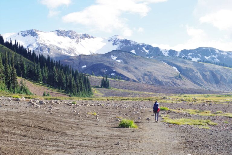
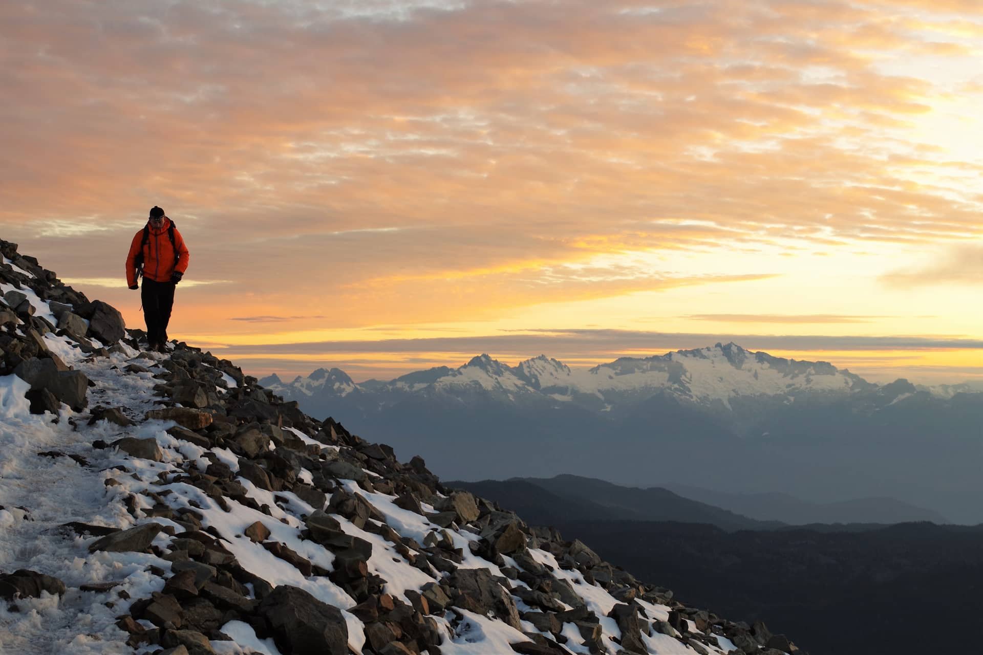
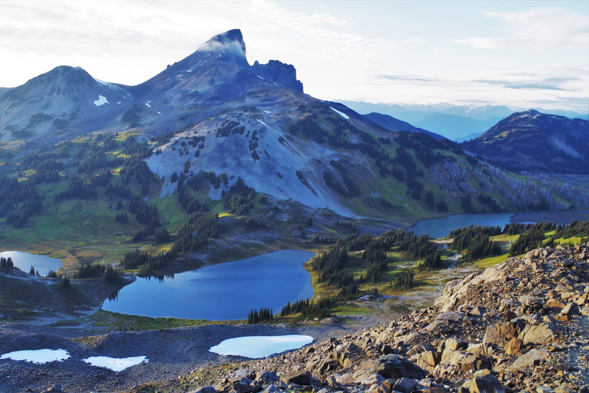
Panorama Ridge offers one of the most spectacular mountain panoramas you will ever see. On one side, the crystal blue waters of Garibaldi Lake. On the other, the imposing silhouette of Black Tusk. If you have the ability, do not miss this opportunity to see these incredible views.
Panorama Ridge is located in the accessible western area of Garibaldi Provincial Park, which is itself mid-way between Squamish and Whistler. Whilst its peak isn’t the tallest of the surrounding mountains, its proximity to the Garibaldi Lake gives it one of the most spectacular views in BC.
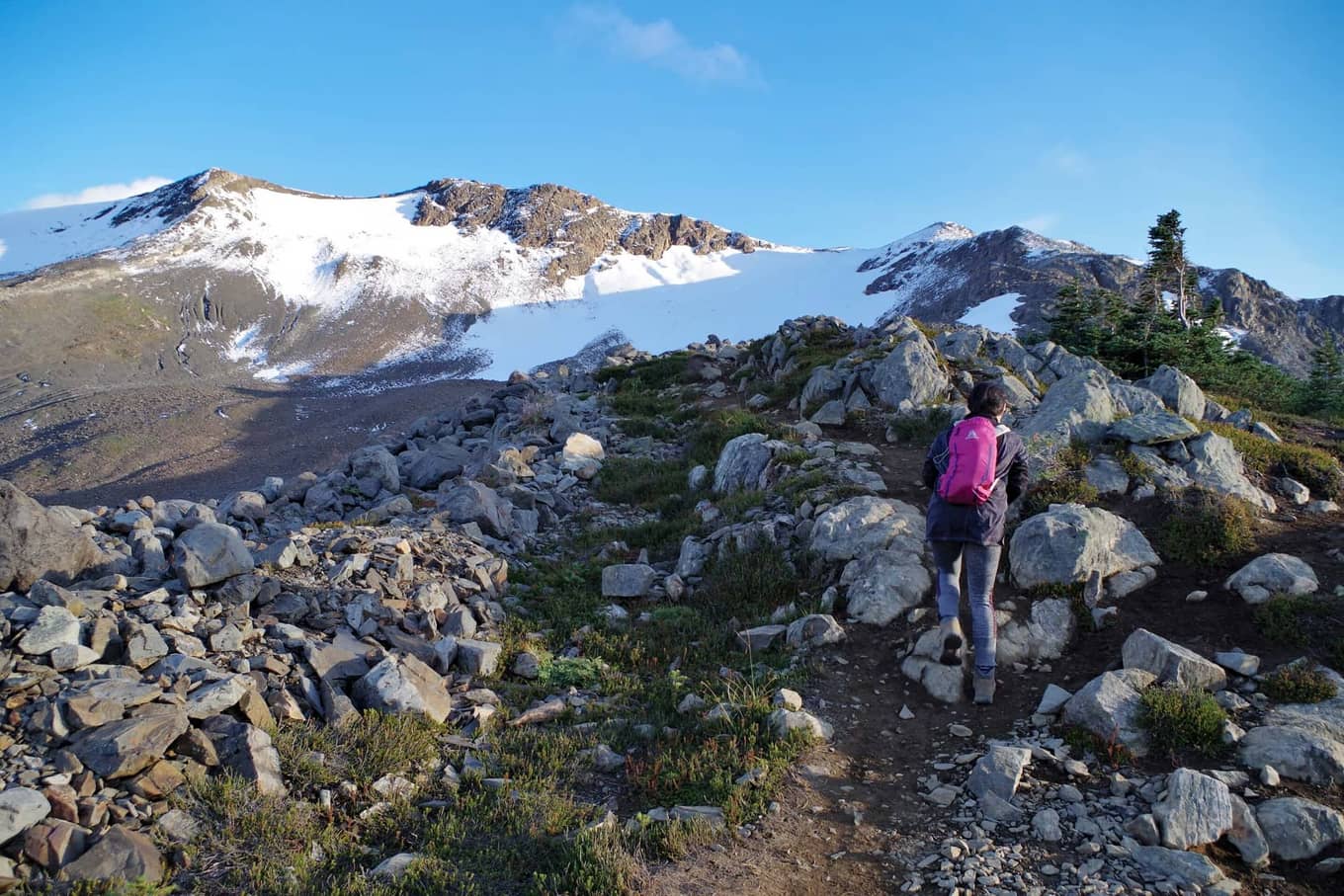
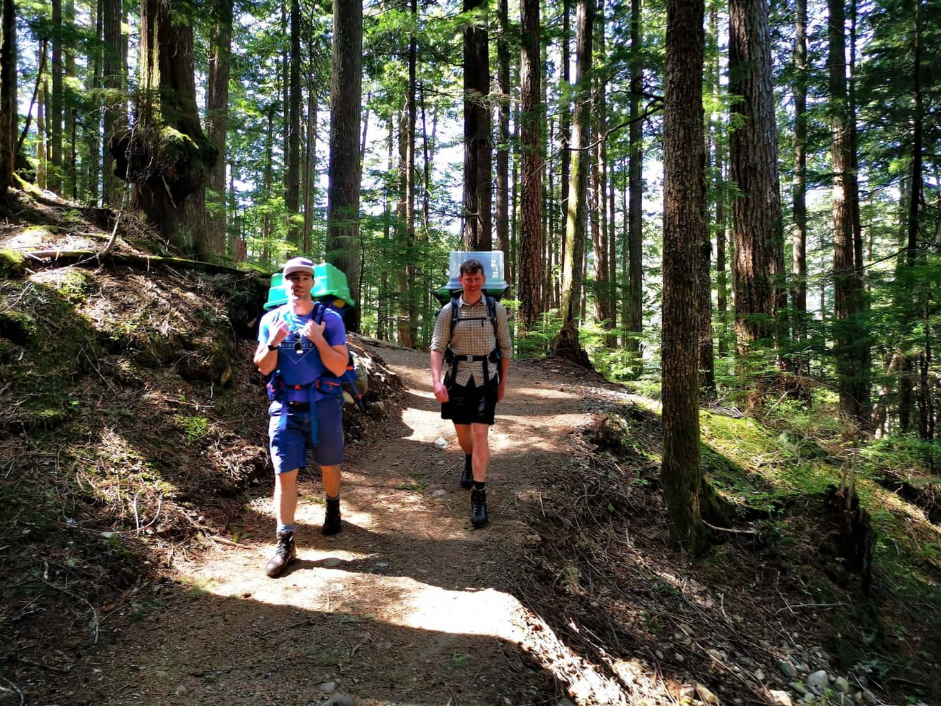
At just under 30km, the trail from Rubble Creek is the simplest and shortest way to reach Panorama Ridge. That said, even this route covers a significant 1500m of elevation, categorizing the route as Very Difficult for a day hike. The trail can be divided into three main sections: Stage 1: The trail maintains a steady incline up a well-maintained path, for the first 6-7km. The trail covers endless switchbacks through dense forest and to be honest isn’t that interesting. It's tolerable only becau
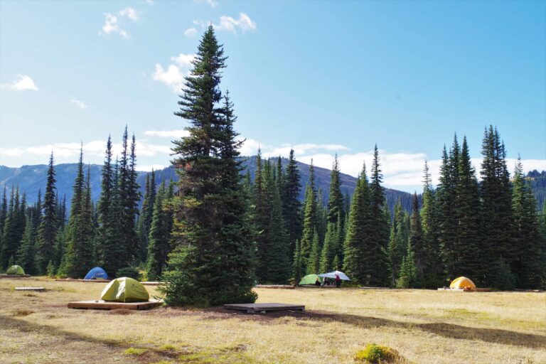
There are several camping options if you want to make Panorama Ridge into a multi-day hike.
Garibaldi Lake Campground, Taylor Meadows and Helm Creek are all viable options and all provide some facilities including outhouses, eating shelter etc. You'll find detailed information about each on the Panorama Ridge Detail Tab. Generally Garibaldi Lake Campground is the most popular camp due to its lakeside location.
To reach the Rubble Creek Trailhead drive approx 30km past Squamish, and watch for the well-marked sign guiding you to Garibaldi Lake and Black Tusk. You'll spend a few kilometers on a well maintained gravel road before reaching the very obvious parking lot.
You can find the official BC Parks map for Garibaldi Provincial Park here.
The main hike listed on this Overview Tab is the most popular route, done from Rubble Creek Trailhead. There is one other option listed below. Both routes are in the region of 30km and involve significant elevation, so bear that in mind before committing to such a big day. This is not a day hike for occasional hikers.
If you intend to start from Rubble Creek then your only real decision will be whether to take the more direct route up through Taylor Meadows, detour via Garibaldi Lake, or do one of each one the way up and down.
My recommendation would be to go up via Taylor Meadows, and take a break at the lake on your way down. With a little sun, you’ll have yourself a nice little post-summit dip. Don’t expect it to be warm though – this is an alpine lake after all.
The Helm Creek option which starts at the Cheakamus Lake Road parking, is not significantly different in length, but in my opinion is much more scenic. After crossing the river at the start, you’ll quickly head up a bunch of switchbacks through the forest, before the gradient starts to ease. As you pass the Helm Creek Camp, the trees start to open up onto meadows, ponds, and valleys. With such open vistas, it’s hard not to love this route.
With a little logistics and some shuttling, it’s very possible to go up one route, and down the other. I would recommend your whole group travel in the same direction, meaning you’ll have to shuttle at the beginning or the end of the day. Leave one car at Rubble Creek, and one car at Cheakamus Lake Road Parking.
The alternative which I’ve heard some people do is to arrange to swap keys with another group half way through the route. I’m not keen on this arrangement as you then become dependent on another group. Unexpected events or injuries may screw your day up, in an area where there is the added complexity of no cell signal.
You have three options for camping.
Officially, there are no clean water sources in Garibaldi Provincial Park. If camping overnight, you’ll either need to bring with you everything you need, or more realistically bring some kind of water filtering device. Look our for my recommendations on this soon.
Planning a trip with multiple potential start points, objectives and camp grounds can make estimating distance tricky. I’ve pulled together this table of distances to help you do just that.
| Distances (Km) | RC | TM | GL | PR | BT | HC | CR |
|---|---|---|---|---|---|---|---|
| Elevation (m) | 575 | 1500 | 1470 | 2070 | 2300 | 1550 | 850 |
| - | |||||||
| Rubble Creek (RC) | – | 6.8 | 8.8 | 13.0 | 11.5 | 15.4 | 23.6 |
| Taylor Meadows (TM) | 6.8 | – | 2.4 | 6.2 | 4.7 | 8.6 | 16.8 |
| Garibaldi Lake Camp (GL) | 8.8 | 2.4 | – | 6.7 | 5.2 | 9.1 | 17.2 |
| Panorama Ridge (PR) | 13.0 | 6.2 | 6.7 | – | 6.1 | 6.7 | 14.8 |
| Black Tusk (BT) | 11.5 | 4.7 | 5.2 | 6.1 | – | 8.5 | 16.7 |
| Helm Creek Camp (HC) | 15.4 | 8.6 | 9.1 | 6.7 | 8.5 | – | 8.1 |
| Cheakamus Lake Road (CR) | 23.6 | 16.8 | 17.2 | 14.8 | 16.7 | 8.1 | – |
| Dist (Km) | RC | TM | GL | PR | BT | HC | CR |
|---|---|---|---|---|---|---|---|
| Elev (m) | 575 | 1500 | 1470 | 2070 | 2300 | 1550 | 850 |
| - | |||||||
| RC | – | 6.8 | 8.8 | 13.0 | 11.5 | 15.4 | 23.6 |
| TM | 6.8 | – | 2.4 | 6.2 | 4.7 | 8.6 | 16.8 |
| GL | 8.8 | 2.4 | – | 6.7 | 5.2 | 9.1 | 17.2 |
| PR | 13.0 | 6.2 | 6.7 | – | 6.1 | 6.7 | 14.8 |
| BT | 11.5 | 4.7 | 5.2 | 6.1 | – | 8.5 | 16.7 |
| HC | 15.4 | 8.6 | 9.1 | 6.7 | 8.5 | – | 8.1 |
| CR | 23.6 | 16.8 | 17.2 | 14.8 | 16.7 | 8.1 | – |
As with almost any hike in BC that isn’t in a city, you are venturing into bear country. You should come prepared with bear spray, though I should note that I’ve never had to use mine. Just because you have bear spray doesn’t mean you should go looking for bears. In fact, you should generally make noise as you hike to give animals ample time to hear you coming and move on. If there’s one thing bears hate, its being startled.
Generally, the popular parts of Garibaldi Park are only frequented by black bears. However, grizzlies do live in the park and contrary to popular belief, are occasionally spotted. A few years back, Ayelen and I were hiking up through Taylor Meadows and came across the bear in the picture below. At the time I thought it was a black bear, though when I happened to show my pictures to the president of the Grizzly Bear Foundation a couple of years later, he confirmed that it was a Grizzly.
On that occasion, the bear was blocking the path, and wasn’t moving on. We decided to turn around and hike to the lake instead. In hindsight, I guess we made the right decision!
Reach out with your questions!
Subscribe to download this content!

Evo is a car share program which operates in both Vancouver and Victoria. They help reduce car ownership and encourage car sharing. Whether you live in BC or are visiting from abroad, Evo is a great way to get around with minimal fuss. Their cars are even equipped with bike and ski racks if you’re heading to the mountains!
The below promo code will give you $25 free driving credit and earn me a small referral fee to help me maintain this website.
Add Review