The highways of British Columbia give you access to some of the most incredible scenery anywhere in the world. Distances are vast, communication is potentially challenging and conditions are variable. It’s important to know what you’re dealing with and how to prepare for a successful road trip.
Below you’ll find all the most helpful resources for planning your trip and navigatings this beautiful province.
Table of Contents
BC Road Conditions & CAMS
Maps and Resources
If you’re after current road conditions, highway cams, road closures and more, Drive BCs Road Map is your place to look. Either use the tool below, find the link to a full screen version here, and the official drive BC site here.
Instead of clicking through the required filters each time you use the tool, these shortcuts allow you to skip quickly to a preset view:
- Traveling Now View – Current conditions, highway cameras, incidents and road closures.
- Travel Planner View – Planned events, weather forecast, incidents and road closures,
Winter Driving Conditions
The highways of British Columbia include many areas of mountainous terrain. It’s really important, especially in winter to check weather conditions before you travel. The above resources form Drive BC provide a great way to stay up to date on all current conditions, variable traffic signage, accidents etc.
Depending on where you’re going, you may be required to have snow tires at certain times of the year. The BC Provincial government website has plenty of information detailing this advice, as well as plenty of other resources about driving in BC.
The below video shows potential driving conditions on the Coquihalla Highway in the depths of winter. These conditions don’t last all winter long, but it’s well worth knowing what you might find if you travel when it’s particularly cold, or bad weather.
Road Trip Inspiration
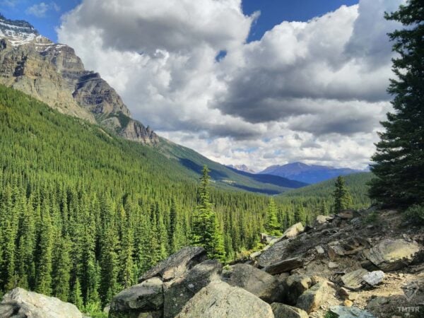
If you’re planning a trip around BC and are looking for some inspiration, look no further than this adventure explorer, with everything from hikes and walks to kayak and canoe trips, bike packing and road trip ideas.
I’ve placed just a few ideas here, though if you want to search by activity type and region, check out the adventure explorer.
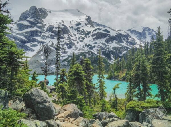
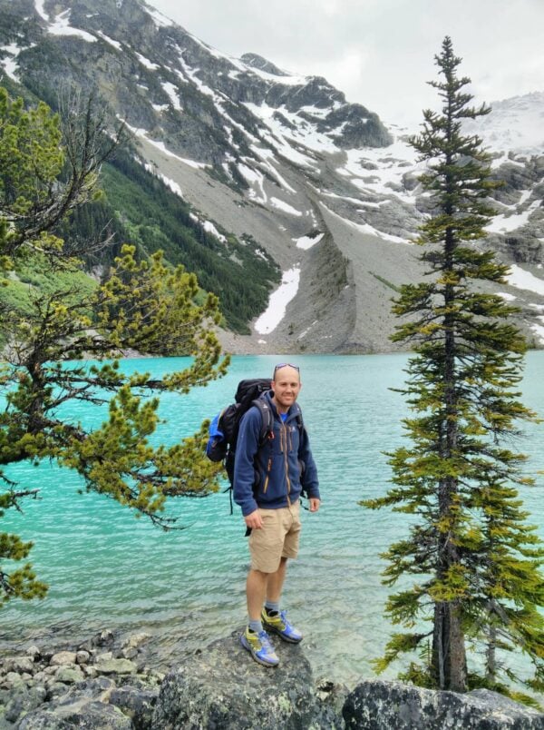
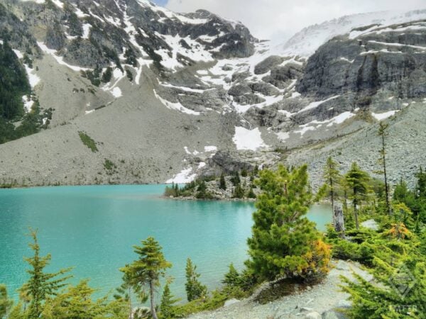
Joffre Lakes
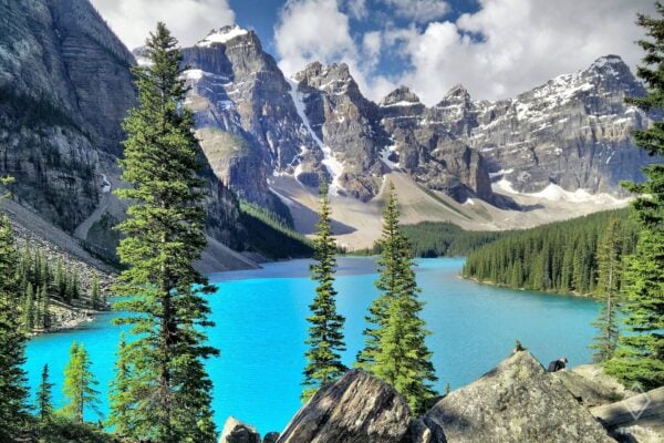
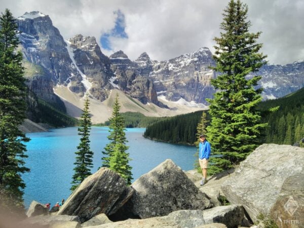
Moraine Lake
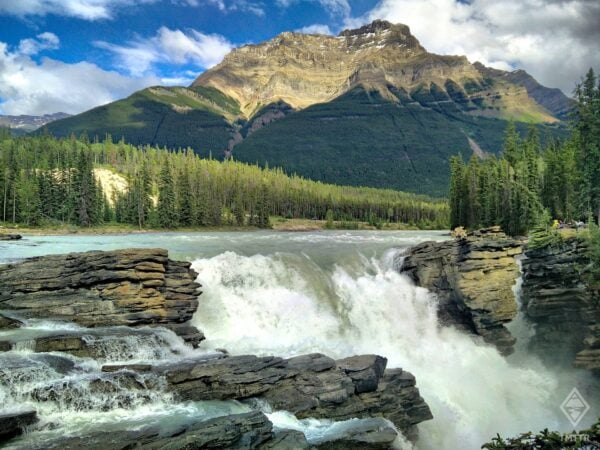
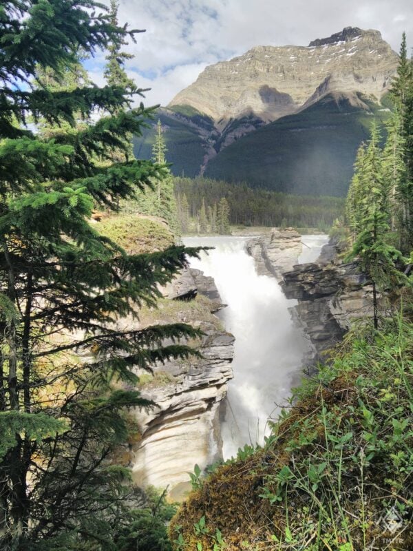
Athabasca Falls
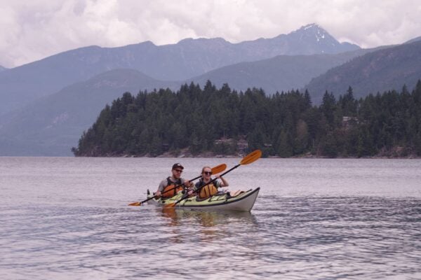
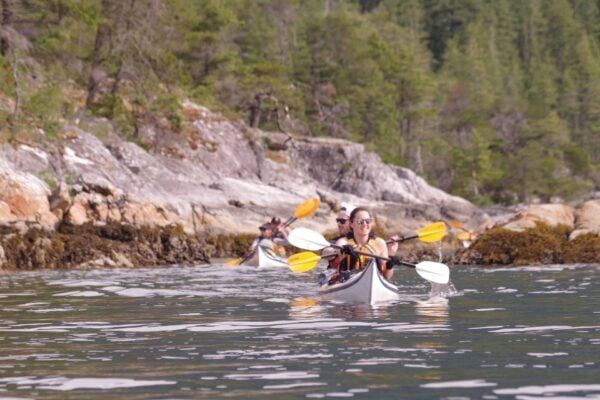
Paddling the Sechelt Inlet
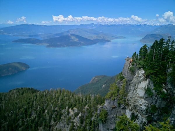
St Mark's Summit
Planning & Preparation
Road Closures in BC
Being such a big province, British Columbia often only has one major route connecting two places. The alternative often requires many hours of detour. For that reason, when big accidents or poor conditions cause road closures, it is not uncommon for big highways to be closed for a few hours. You do not want to get caught out without warmth, food and water. Always make sure you have these things in your car, and check the forecast.
I’ve had to sleep in my car for 4 hours in similar conditions to the above video (-20C) due to an accident blocking the Coquihalla Highway mountain pass. Thankfully I was cozy and slept well. Without preparation, this would have been a very different story.
Food, Water & Supplies
If you are diving far, over mountainous terrain, far from towns, or in any potential for poor driving conditions, make sure you have supplies to keep you hydrated, fed and warm if you find yourself stuck, and waiting for help to arrive. I keep a Jetboil mini stove in the back of my car during winter, which is great for making cups of tea or coffee on the go. You’ll need to bring a small gas canister too, though that even fits inside the stove too. My parents were so impressed by the Jetboil when they visited that they went straight home and bought one.
I would also recommend you have the following in your car, with the warm items especially important during winter:
- Supply of water
- Snacks
- Sleeping bag or warm blanket (I had to sleep in -20C)
Driving Insurance in British Columbia
If you’re going to be renting a car or camper, it’s well worth knowing how insurance works in Canada. Read my car rental guide here.
If you plan to drive down any forest service roads (unpaved/gravel roads), read your rental insurance policy very carefully. Often they won’t cover you when you leave paved roads. Alternatively, you can purchase per day driving insurance from ICBC for $10 a day (as at 2020), which does cover you for gravel road driving. It’s not well documented on their website, but if you ask any Autoplan broker they’ll immediately know what you mean. Remember, always check the details of your insurance policy before you travel.
Breakdown & Recovery Insurance
If you own a car in BC, it’s well worth having breakdown cover to get you home should you need it. The cost of paying for these services on the spot will put a serious dent in your wallet. Consider buying breakdown cover in advance. I was thankful to have my breakdown cover when I was towed 200km back to Vancouver. I won’t be cancelling it any time soon!
-
- BCAA (BC Automobile Association) provide comprehensive breakdown cover, ideal for peace of mind on long road trips. You can get towed multiple times in a year and their service has always been excellent. Their insurance protection also covers battery replacement if your car or truck battery dies.
- If you are driving on Forest Service Roads, consider that you may need additional insurance if you’re in a rental vehicle. Check out the Intro to Backcountry Driving in BC for more info.
Navigation
Always download an offline map before your trip. You WILL lose phone signal. A few suggestions below:
- Google Maps – you can download an offline area
- MapsMe – a great app that gives you GPS directions without a data connection.
- GAIA GPS – more designed for outdoor adventures, hikes, biking etc, but nonetheless a useful resource.
To see a list of my favorite mapping apps, check out this link.
Driving and navigating in BC quickly leads you far from developed areas. You’ll almost certainly spend part of your journey without phone signal. So you either need to download an offline map (as above), or you need a physical map in your car. If you’re exploring the outdoors, then there’s a good chance you’ll even venture off the main highways and even down an unpaved forest service road.
BRMB map books have a ridiculous amount of detail showing BC’s road network, back-country roads, hot-springs, trailheads, waterfalls etc. I always try to carry a paper version in my car when going on a road trip. They also sell large waterproof versions too.

Driving Laws & Rules in BC
Driving in BC with a Foreign License
As a visitor to British Columbia, you can drive using a foreign license for a up to 6 months, or with an International Driving Permit for a period of 1 year. Importantly, however, if you are a new resident of BC you have 90 days from your arrival to switch to a BC driver’s license.
Resources
- Welcome BC have the most comprehensive guide to foreign license regulations. If you’re at all uncertain, check it out.
- The Insurance Corporation of British Columbia (ICBC) also deal with driver licensing and have a wealth of resources that might help.
9 Traffic Laws You Should Know in British Columbia
Every country has its own quirky driving laws, and Canada is no different. Here are nine local traffic laws that you should be aware of before driving in BC.
- Canadians drive on the right.
- Canadians love STOP signs. In fact, you’ll probably see more of them in an hour than you’ve seen in your whole life. Four-way stops are particularly common, with drivers taking turns to advance.
- Cars and pedestrians use junctions at the same time. This means if you’re turning left or right, you may have to wait for pedestrians to cross, as well as look out for traffic. Take it steady – it takes some getting used to.
- There seem to be various interpretations about who has the right of way at a roundabout – expect the unexpected and you’ll be fine!
- It is permitted to turn right on a red light, assuming you have come to a full stop first. Be cautious as there may still be pedestrians crossing.
- U-turns are technically illegal. I was ticketed for this, even though the officer agreed it was perfectly safe. I would certainly avoid U-turns in big cities.
- Cars must park on the side of the road corresponding to the direction of traffic. You will get a parking ticket for not following this rule (I’ve personally had friends that got caught out by this one).
- Traffic tends to come to a firm stop to allow emergency vehicles to pass. This is different from many European countries where people generally just move aside and keep moving. Watch out for the car in front!
- It’s worth noting that technically you can’t park in front of someone’s house for more than three hours, though I’ve never seen this enforced. Just be considerate.
Vehicle Rentals
Car & Truck Rentals
There are many car rental websites available with prices changing as you would expect throughout busy and quiet seasons.
In addition you’ll find a few carpooling schemes here in Vancouver (such as EVO) that allow you to pick up and drop off a car at the click of a button on your app. If you are visiting from outside the province, I recommend you sign up well in advance, so they have time to review your driving license.
RV Rentals
Perhaps you’re looking for an RV instead? Either way, you’ll find all the car rental and RV rental resources you need at this link.
Frequently Asked Questions
Fuel and Transmission
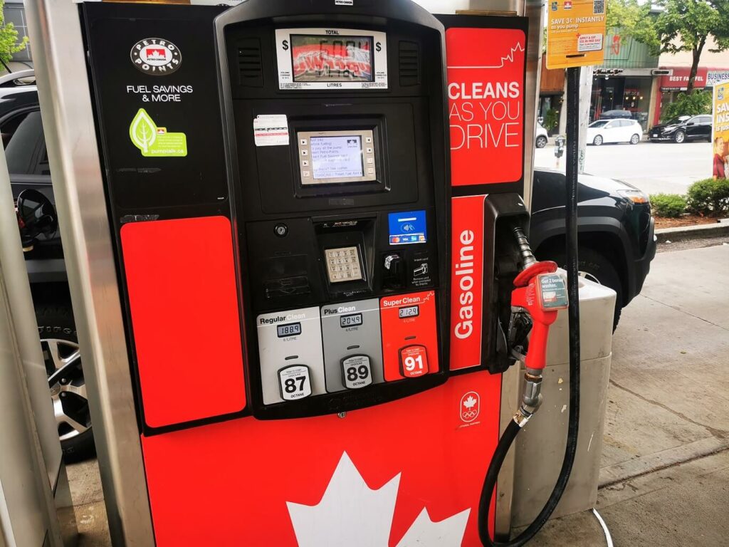
The car you drive will almost certainly be unleaded, and everyone refers to this as regular ‘gas’. Gas stations do offer diesel, but it is far less common. Every rental car I’ve had in BC (many) has been unleaded.
Regular gas (unleaded) is on the red pump, which is confusing for Europeans who’ll be used to unleaded in green. And many pumps don’t have Diesel at all.
Gas stations tend to be pre-paid. You set the max amount you want your card to be charged, pay at the pump and then you’re good to go.
For longer trips, it is worth considering the availability of gas stations. It’s possible to find stretches as long as 250km without a fuel station, especially if you’re traveling further north. Plan before you go, and think about carrying extra fuel, especially if you’re venturing down forest service roads.
Almost every car you come across will be automatic transmission.
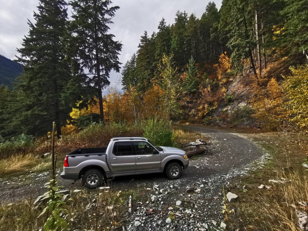
What are Forest Service Roads?
British Columbia has a unique and huge network of Forest Service Roads that were developed to enable the logging industry. Many of these roads are used by adventurers and backcountry enthusiasts as a means to access more remote terrain. These roads take you onto gravel roads, some 4×4 only terrain, and often well out of phone signal. Driving on these roads should be done with appropriate planning and preparation.
For tips on backcountry driving on forest service roads, check out my recent blog Introduction to Backcountry Driving in BC – Tips and Trip Suggestions
Driving in the United States
Crossing Borders into the United States is relatively easy assuming you have the correct visa. The road boarder crossings can get busy at times. You can find the current border crossing wait times here. The main factor to check with US travel is your insurance coverage and whether it changes at all when you cross the border. In particular, I know that the default coverage for being hit by an uninsured driver tends to differ when you cross the border. Check with your insurance and ask lots of questions.
Driving in Other Provinces
From British Columbia, you may end up crossing into another province of Canada. Whether it’s the Yukon or North West Territories to the north, or Alberta to the East. There are no border crossings as such, but you may wish to check with your insurance what conditions they have or if your coverage changes at all.
Toll Roads in BC
There are no longer any toll roads in BC. When they existed previously, rented cars were equipped with a sensor so that you’d be charged directly to your credit card.
Useful Links & Resources
There are so many great resources for trip planning and route evaluation. You’ll find them all in the resources section of this site, but here are a few ones you’re guaranteed to use.
Drive BC Road Conditions – Shows road weather conditions, web cams, variable warning signs for the whole province.
BC Ferries – Is your source of all information when you need a ferry, including route maps, schedules, bookings and last minute capacity.
Firesmoke.ca – is a great resource to check smoke forecasts during the summer forest fires. These are an important factor in your travel plans during summer months when wild fires rage across the province.
Weather Forecasts – are super important, particularly when planning longer trips to more exposed and higher elevation areas prone to snowfall and ice. Below is one of my favorites from Windy.COM.
